
Onward to Tibet (Day 3 or 4)
First Stop - Nyalam (3,750 m / 12,300 feet). Assuming all goes well with the Chinese Embassy visas, we will push off for Tibet via bus to our first stop. The first leg of our approach takes us to Nyalam. Below is a map of all the towns along the Friendship Highway with Everest in the lower left hand side of the map below. NOTE: Google maps says..."Sorry, we could not calculate directions from "Kathmandu, Nepal" to Nyalam, Shigatse, Xizang (Tibet), China." I think the sorry state of affairs in the region are the real problem - not Google's inability to calculate distance and directions. I can plot out footsteps in my neighborhood using google maps! Why can't I get a distance between two cities? Bummer.

Below is a great video that shows the journey (a brief 3 minute video of the entire trip with some highlights):
Thanks to Jerome Ryan (linked to video) for providing that video footage and posting it on youtube.
Nyalam is located 12,300 ft above sea level just off the Friendship Highway and offers an ideal location to stop to acclimatize. Mark Horrell, the author of a great book on Everest I mentioned in a previous post, wrote a funny note about Nyalam entitled "The only way to acclimatize in a dirty old town." He describes the place as if it were a medieval town so barren of creature comforts that it warrants little attention - save for the need to acclimatize before heading onward. Mark cracks me up. He documented his climbing teams' beer consumption in this town and even higher up on the mountain. I loved his diaries and recommend the blog and his book to anyone interested in Everest as a follower or a climber. Mark seems like a great guy and I hope our paths cross one day - perhaps when I swim the channel (another blog for another day). According to the Summit Climb schedule, we will be in Nyalam for two days to acclimatize.
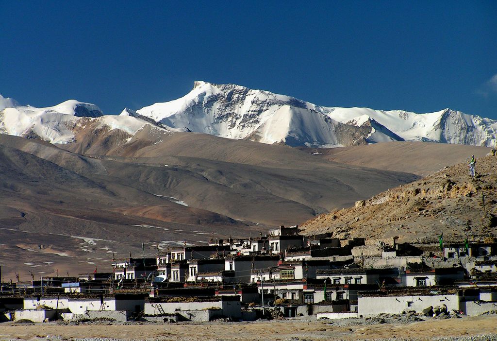
Second Stop - Tingri (4,300 m / 14,100 feet). Another bus trip toward a two-day stop in a small town allows us to gradually acclimatize further. Below is an awesome shot of Tingri and the surrounding mountains.
The bus travels along the Friendship Highway from Nyalam to Tingri - located just 217 km apart. According to google maps (see picture below), the trip ought to take 5 hours. Let's consider that speed for a moment. A 217 km distance in 5 hours gives you roughly a 27 mph pace (43 km/hr). While it is true that no runner can even approach that pace, I am sure a good off-road cyclist might give that pace a go for the money. Maybe Google's expected time includes breaks, shopping, eating, bathroom stops, etc. I don't know but that sure seems slow. Here is the map as promised:

NOTE 2 RE: Google Maps. Apparently, once we enter into Tibet, Google maps was able to calculate distance and time. Hey google, give us a darn distance between international cities, would you? OK, enough ranting.
Next stop...Chinese Base Camp. See you tomorrow.
No comments:
Post a Comment